Bathing Optional
Patagonia : Sept.- Oct. 2006


-
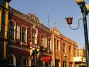
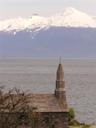
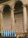
 Pucon, Chile´s adventure capital, a cute town along the shores of Lago Villarica in the Lake District.
 -
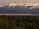
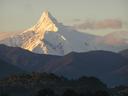
 Beautiful Volcan Villarica can be seen from pretty much anywhere in town.
 -
 Volcan Villarica, active, but generally quiet.
 -
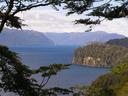
 Small bay along Pucon´s part of huge Lago Villarica.
 -
 The Lake District and much of southern Chile still has a strong Mapuche Indian culture and population.
 -
 Male Mapuche statue just across the trail from the female.
 -
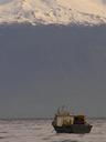
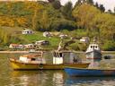
 Boats at the small pier.
 -
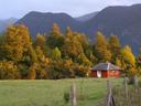
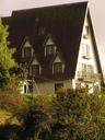
 Homes along the lake.
 -
 Lake views from Pucon´s main beach. Gorgeous!
 -
 The lakeside beach.
 -
 The volcano, again.
 -
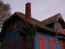
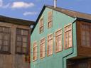
 Typical building in Pucon -- all wood, shingles and stone.
 -
 How did this advertisement get a hold of OUR motto?!
 -
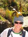
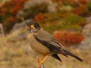
 Local (very loud) birdlife.
 -
 A beautiful, small creek ran through our campground in Pucon.
 -
 Creekside boardwalk.
 -
 Rustic bridge.
 -
 The unkept picnic site at our campground looked great!
 -
 The old lady running the campground had a handful of cats and a dog.
 -
 The camplady´s beautiful home.
 -
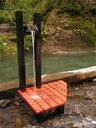
 These signs, directing drivers to hotsprings could be found EVERYWHERE in the hills and mountains surrounding Pucon. We chose Termas Los Pozones, the most rustic springs.
 -
 Ashe, enjoying our late night visit to Termas Los Pozones where we soaked in the 5 different rock pools for more than 3 hours!
 -
 Our tent and OUR CAR. Yes, we rented a car for a day to better get around the unserviced dirt roads in the hills around Pucon. It was the first time for Maciej to drive standard since we bought the standard car in New Zealand during our last trip and all went well... !
 -
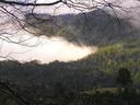
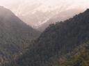
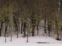
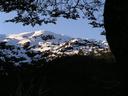
 Morning mist in the mountains.
 -
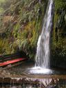
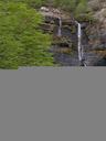
 Our day with the rental car was spent driving from waterfall to waterfall. The first, this one.
 -
 The second waterfall along the Treis Saltos trail.
 -
 Maciej in a bamboo forest along one of the waterfall trails.
 -
 Views from the trail up the hill to the third waterfall.
 -
 Mountain views from the trail.
 -
 Cold morning mist drifting away.
 -
 A fourth (secret?) waterfall along the Three Falls trail.
 -
 And another one, the third of the Los Treis Saltos trail.
 -
 We spent most of the day walking simple, lush trails like this one.
 -
 Chile is so green and we love it!
 -
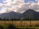
 Typical Lake District countryside.
 -
 What´ll it be? Maciej behind the bar in a riverside cabin.
 -
 Bear.
Bear. -
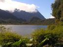
 A quick stop along Lago Tilquilco in Parque Nacional Huerquehue.
 -
 Great lake views.
 -
 The Andes rise majestically over most lakes in the Lake District.
 -
 Lake views.
 -
 Ashe, enjoying the beach, sun and views at large Lago Caburgua very much!
 -
 Lago Caburgua views.
 -
 More Lake Caburgua views.
 -
 Huge trees sit right on the beach.
 -
 Another rustic bridge through the rainforest leading to a waterfall.
 -
 The Ears of the Caburgua River Falls.
 -
 Looking down the Falls.
 -
 Maciej in the forest.
 -
 Great trees along the trail.
 -
 Views from our rental Fiat.
 -
 Love those green mountains.
 -
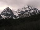
 Nearing the Chilean-Argentina border, the mountains got larger and more imposing.
 -
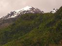 Snowy peaks peeking over green hills.
 -
 Valley home.
 -
 More mountains.
 -
 Jagged peaks as we got closer to the border with Argentina.
 -
 More border mountains.
 -
 Perfect.
 -
 Farm.
Farm. -
 Close to the border with Argentina, the village of Curarrehue is a perfect, little, mountain town.
 -
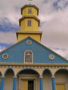
 The old, fully shingled village church in Curarrehue.
 -
 Laundry day.
 -
 On the road back to Pucon and another great country church.
 -
 The amazingly high China Falls.
 -
 Bottom of China Falls.
 -
 Ashe at the upper Falls lookout.
 -
 Us at China Falls and a little wet from all the mist.
 -
 China Falls.
 -
 Lots of bamboo in the lush forest trail to and around the Falls.
 -
 Mapuche Indian totem pole deep within the forest along a long, long dirt road in the middle of nowhere.
 -
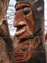 Totem pole faces.
 -
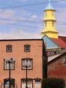
 Another great little church.
 -
 Along the shores of Lago Calafquen, one of our favorites.
 -
 Lago Calafquen.
 -
 Beach at Lago Calafquen.
 -
 Colorful trees along the lakeshore.
 -
 For all those hotsprings (and onsen) lovers out there, check these out! Deep in the valley north of the tiny town of Conaripe, Termas Geometricas are perhaps the most incredible hotsprings we´ve ever seen (and Maciej has visited plenty in Japan)!
 -
 Wow, these hotsprings are amazing!
 -
 If you get tired of all the hot pools, you can get soaked under a natural waterfall right by the springs.
 -
 The red and black colors at Termas Geometricas are definitely reminiscent of Japan.
 -
 Small shoulder massage station.
 -
 The boardwalk at the hotsprings follows the deep gorge for a long, long time all the while shrouded in mist from steaming springs.
 -
 Following the boardwalk up to a small rest shelter.
 -
 At the very end of the gorge, a beautiful waterfall.
 -
 The waterfall.
 -
 A couple seats with waterfall views.
 -
 Maciej, REALLY loving this hotspring resort!
 -
 Sunset clouds over the valley on our way back down from the springs.
 -
 Evening light.
 -
 More sunset skies.
 -
 Brilliant!
 -
 Great farm!
 -
 Fantastic sunset over Lago Calafquen!
 -
 Sunset cross.
 -
 Sunset colors over the lake.
 -
 Final sunset shot over Lago Calafquen. What a day it was -- we really got around in our little rental Fiat!
 -
 Leaving the Lake District and heading for the coast...
 -
 Valdivia, southern Chile´s historic port town near the coast and along the Calle Calle River.
 -
 Historic block in Valdivia.
 -
 Colorful, historic building along Valdivia´s port.
 -
 Valdivia´s main plaza.
 -
 Old building along Valdivia´s main plaza.
 -
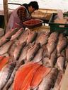
 The most interesting thing in Valdivia: its riverside fish and produce market.
 -
 Pelicans and seals line the edge of the fish market, waiting for handouts.
 -
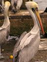 Pelicans.
 -
 Slicing up fresh fish.
 -
 HUGE seal waiting for fish scraps.
 -
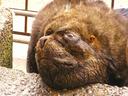 He´s had WAY too much free food!
 -
 Look at the size difference!
 -
 All kinds of sealife for sale.
 -
 Vendor.
 -
 Fish.
Fish. -
 Bigger fish.
 -
 Vendor.
 -
 Another vendor.
 -
 Feeding the monster.
 -
 More seals.
 -
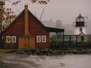
 Dock views from our campsite in Valdivia.
 -
 Kittens!
 -
 Late in the afternoon, we took a small trip out of Valdivia, to the coast where we had to take this boat across the wide river over to our destination: Corral.
 -
 Passengers on the small boat ferry.
 -
 Views of a nearby island from our boat ferry to Corral.
 -
 Approaching Corral.
 -
 Corral, along with 2 other small nearby port towns, has the remains of an old Spanish fort used by the Spanish to wage their losing battles in the final days of Chilean colonialism.
 -
 The streets of Corral.
 -
 Rooftops in Corral.
 -
 Corral street.
 -
 Side by side.
 -
 Old teapot in home window.
 -
 Inside the old Spanish fort.
 -
 The views the Spanish had as Lord Cochrane´s Loyalist ships sailed in to capture the port.
 -
 Views to the river along the fort´s walls.
 -
 Homes above the fort.
 -
 Views across the bay from the fort tower.
 -
 Canon and mossy bricks.
 -
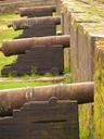 Cannons, lined up and ready for battle.
 -
 Last look over Corral as we took the boat ferry back to Isla Teja and Valdivia.
 -
 Views across Lago Panguipulli, further south in Chile´s Lake District.
 -
 Volcan Choshuenco above Lake Panguipulli.
 -
 We found this market in the town of Panguipulli. The owner must be a huge Alf fan.
 -
 Shelter along the lake.
 -
 A long day of bus after bus finally brought us to the surprisingly tiny port of Puerto Fuy on the western end of long Lago Pirehueico. This should have been our first hint that this ferry-bus combination trip across the border to Argentina is not a very common one.
 -
 Downtown Puerto Fuy.
 -
 Riverside home in Puerto Fuy.
 -
 Local church.
 -
 Shrine.
 -
 Mountain views in Puerto Fuy.
 -
 When we arrived, we found out that the next logging ferry would not traverse the lake until the next day at noon. Spotting these two boats on the beach, Maciej got an idea...
 -
 Why not row the length of the lake? If the ferry takes 2 hours than, if our calculations are correct, we should be able to row it in about 15 hours...
 -
 Camping on the beach, waiting for the logging ferry.
 -
 Ashe, all bundled up in the tent. That night in Puerto Fuy was our coldest one yet!
 -
 We took a great morning walk along the shores of the lake and found this interesting tree.
 -
 As the morning rays of sun through the trees, the grass and beach steamed, the cold of the night drifting away.
 -
 Our walk came to an end at this creek feeding the lake. We definitely didn´t want to ford those icy waters.
 -
 Mist rising off colorful hills.
 -
 Us on the beach at Lago Pirehueico. We were so cold the evening before that we had to pick up another layer of clothing and bought these nice hand-made sweaters at the convenient store for $4 each -- great deal!
 -
 Finally, the ferry departed from Puerto Fuy and we were on our way east on Lago Pirehueico, heading towards the border and Argentina.
 -
 Views from the ferry.
 -
 Great views from the ferry.
 -
 Beautiful snowy peaks glowed in the morning sunlight.
 -
 A night frost had drawn a clear line across the top of the mountains with trees transitioning from green to frosty white. It was an incredible sight!
 -
 Treetops.
 -
 Rocky cliffs.
 -
 The views were fantastic during the entire ferry trip as the hills along the shores of Lago Pirehueico got steeper and steeper and the lake seemed to sink deeper and deeper into its depression.
 -
 Lakeshore views.
 -
 Snowy mountains above it all.
 -
 Fabulous views to the north as we approached our destination, Puerto Pirehueico, the even tinier port village on the east end of Lago Pirehueico.
 -
 Looking back from where we had come.
 -
 Surreal.
 -
 The heavily forested shores of Lago Pirehueico.
 -
 As suspected, there were no signs of a bus at Puerto Pirehueico and the weekly bus wouldn´t arrive for 3 days so it was off on foot. Only 17 kms to the border of Chile-Argentina.
 -
 Forest views as we made the hike for the border.
 -
 Finally! We made it across the border and found this great little church on the Argentinian side.
 -
 A few kilometers further into Argentina we finally got to Lago Lacar. Great -- only 47 kilometers to our destination, the town of San Martin de los Andes. Still no signs of a bus or transport of any kind. We definitely chose a backwoods way to cross from Chile to Argentina.
 -
 We made it to beautiful San Martin de los Andes (named for the man on this horse; Argentina´s liberator) THAT evening! Luckily, an incredibly kind and helpful French trio had picked us up in their rental car and we didn´t have to hike the 40km to town. They even took us to a grocery store, to the campground, and had dinner with us!
 -
 San Martin, City Hall.
 -
 San Martin is full of wood and stone, chalet-style buildings typical of the entire Lake District.
 -
 San Martin sits right at the foot of beautiful Lago Lacar.
 -
 Lakeside deer (statues).
 -
 Great log cabin in San Martin.
 -
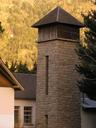 School tower.
 -
 Typical street in San Martin.
 -
 Another great chalet-type building.
 -
 Another log cabin.
 -
 Amongst the shops along San Martin´s main street we found this chocolate shop. Mamusia´, in Polish, is a very endearing way of saying mom.
 -
 Peacocks.
 -
 Tudor style.
 -
 Another cabin!
 -
 Antlers.
 -
 Another great home in San Martin.
 -
 One more.
 -
 Nice.
Nice. -
 Maciej the Dwarf.
 -
 Treehouse at our campground in San Martin.
 -
 We took a hike along Lago Lacar starting right at San Martin´s beach and found ourselves rising above the lake.
 -
 After just 30 minutes of hiking we came to a rocky outcrop with fantastic views down the entire length of the lake. Somewhere way down there we had made the border crossing into Argentina from Chile the day before...
 -
 The Andes towering high over Lago Lacar.
 -
 Andes.
 -
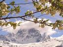
 Blossoms above the lake.
 -
 Views of San Martin from the trail.
 -
 Later that day and on a bus headed south to Bariloche through the wonderful Parque Nacional Nahuel Huapi.
 -
 During the entire 4 hour bus trip we had views of amazing peaks like this one.
 -
 A stop along one of the many, many small lakes in the Park and we spotted this great duck.
 -
 Lake views.
 -
 Geese.
 -
 Mountain cabin deep in the heart of Parque Nahuel Huapi.
 -
 Mountains.
 -
 Back on the road, heading for Bariloche.
 -
 Inside a small cabin.
 -
 More great lake and mountain views along our ride to Bariloche.
 -
 Another peak.
 -
 Nearing incredible Lago Nahuel Huapi. Bariloche is not too far away.
 -
 San Carlos de Bariloche, the Lake District´s premier resort town and for good reason. It is located on the shores of amazing Lago Nahuel Huapi.
 -
 The Lake District´s signature stone and wood architectural style originated in Bariloche.
 -
 Bariloche´s cathedral, lakeside with stunning views across the lake.
 -
 Another classic Lake District facade.
 -
 Nice balcony!
 -
 Log cabin style.
 -
 Nice home up the hill near our hostel.
 -
 Very cute little log cabin style restaurant by the park in Bariloche with trees growing right through it!
 -
 Maciej enjoying the mother of all empanadas!
 -
 Incredible views can be had pretty much anywhere along the shores of amazing Lago Nahuel Huapi.
 -
 Homes and hotels with views line the shores of the lake.
 -
 Amazing.
 -
 Lakeside hotel.
 -
 AMAZING view of Cerro Lopez, one of dozens of brilliant peaks surrounding Lago Nahuel Huapi.
 -
 Another one of central Bariloche´s historic stone and wood public buildings.
 -
 Love those lake views!
 -
 Superb!
 -
 The Llao Llao Resort and Spa. INCREDIBLE location and all the amenities = $1700 US per room, per night.
 -
 Us on the chairlift up Cerro Campanario, a 1035 meter hill with AWESOME panoramic views of snow-capped mountains, lakes, and more!
 -
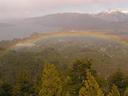 We made it to the peak of Cerro Campanario just in time for the rainbow!
 -
 Rainbow and mountains.
 -
 Us on top of Cerro Campanario.
 -
 Looking the other way from the top, things were a little darker as a storm rolled in. Still amazing!
 -
 Incredible, even with the rain coming in!
 -
 Lago Nahuel Huapi´s beautiful shores.
 -
 More of the lake´s shoreline.
 -
 Despite the storm, every few minutes we would get a glimpse of the giants around us...
 -
 The mighty Andes. We knew we were getting further into Patagonian with the weather changing by the minute, the winds gusting to several score kilometers per hour, and rains coming in.
 -
 A touch of blue.
 -
 Lago Nahuel Huapi.
 -
 Nice colors.
 -
 We were in the middle of a storm-a-brewing but further back down the Lake things looked pretty sunny in Bariloche.
 -
 One last look at the mountains before we began our hike down Cerro Campanario.
 -
 Small shrine on the peak of Cerro Campanario.
 -
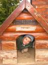 Maciej, in the doghouse.
 -
 It´s raining pine cones!
 -
 View from the bus as we headed back for Bariloche. Love that lake!
 -
 Views across Lago Nahuel Huapi as we took the bus for Villa la Angostura.
 -
 A historic wagon sits by the bus terminal in Villa la Angostura.
 -
 Approaching Villa la Angostura´s historic church with small grotto built into the hill it sits on.
 -
 Climbing the steps to the church.
 -
 It´s a beautiful, little church!
 -
 Inside the tiny church.
 -
 The old village schoolhouse.
 -
 More old school buildings.
 -
 Ashe, enjoying tree fort-like play structure at the old school.
 -
 Swinging!
 -
 Walking the balance beam...
 -
 Typical Lake District home along the lake.
 -
 The dock at Villa la Angostura.
 -
 Another great stone and timber building.
 -
 Sailboat in the bay.
 -
 The very interesting and very unique pine known locally as the pehuen or, in English, the monkey puzzle tree.
 -
 Blue gate with monkey puzzle tree.
 -
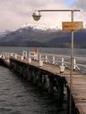 Walking the pier at Villa la Angostura out into the bay.
 -
 Wow! We´re in Patagonia!
 -
 Look at those lake waters!
 -
 Dont take one more step! The steps at the end of the pier drop down into the abyss.
 -
 Great mountains and forests surround picturesque Villa la Angostura.
 -
 Us, at the end of the pier.
 -
 Ashe at the ridgetop mirador in Parque Arrayanes on the peninsula that begins at Villa la Angostura.
 -
 Views from the vista point.
 -
 More great views up the lake.
 -
 Nearby lakes and distant mountains.
 -
 Check out those curves.
 -
 More mountains -- this is our kind of wilderness.
 -
 The very thin isthmus connecting the Arrayanes Peninsula to the mainland.
 -
 The path through Arrayanes Park.
 -
 Views from the trail. Nice!
 -
 At one point, the trail ended. There had been a landslide and we could see the trail continuing on about 40 feet below. We did what any reasonable hiker would do, we used the roots and plants along the cliff to lower ourselves down, foot by precarious foot.
 -
 More great views from the trail!
 -
 Walking the Arrayanes trail.
 -
 Headed for the border between Argentina and Chile (again!) and more great mountains along the way.
 -
 This one turned to be another snowy border crossing. Luckily, we were in a bus this time!
 -
 We woke up back in Chile and along Lago Llanquihue in the town of Frutillar. It was rainy pretty hard.
 -
 Available real estate in Frutillar.
 -
 The rain made for a pretty dark, but still beautiful, morning walk along the lake.
 -
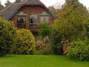
 One of Frutillar´s old, lakeside homes.
 -
 Another home on the lake.
 -
 Colorful homes.
 -
 Hillside home.
 -
 Us on the main drag with the colorful market behind us.
 -
 More local homes along the lake.
 -
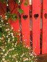 A very inviting fence.
 -
 How could we not smile?
 -
 More rainy views from Frutillar´s lakeside path.
 -
 Great flowers.
 -
 As our guidebook says: The views of Volcan Osorno are stunning from Frutillar. Wow! Look at that volcano!
 -
 Another nice home.
 -
 Great window trim!
 -
 Frutillar views from the main plaza.
 -
 Frutillar has been proudly hosting an annual music festival for the past 60 or 70 years.
 -
 Frutillar, as with many of Chile´s and Argentina´s Lake District towns, proudly flaunt their German heritage.
 -
 Puerto Varas, Chile´s answer to Argentina´s Bariloche but SO different. Puerto Varas DOES have a casino but, overall, it feels much more like a fishing port than a resort town.
 -
 Puerto Varas cathedral, modeled after a church somewhere in Germany´s Bavaria.
 -
 Ship in the waters.
 -
 Us, at Puerto Varas pier.
 -
 Fishing at the pier.
 -
 Puerto Varas, downtown.
 -
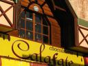 Chocolate shop, one of many.
 -
 Typical, local, wood-shingle architecture.
 -
 Another typical local home.
 -
 Another home, forgotten.
 -
 Another great, local home.
 -
 Approaching Puerto Varas´ cathedral.
 -
 What a change from our recent visit to Argentina! This Chilean Lake District town substitutes rolling, green hills for white mountains.
 -
 The weather began to clear by the end of the day in Puerto Varas and we could begin to make out the perfect cone of Volcan Osorno in the distance
 -
 That evening, we got to tiny Ensenada at the other end of Lago Llanquihue and right under Volcan Osorno. The volcano looked amazing!
 -
 Sunset from our beach camping spot.
 -
 Morning. Sunrise. Clear skies. Volcan Osorno looked fantastic from our beach campsite!
 -
 Beyond the slopes of Volcan Osorno, the second of the three volcanoes protected in Parque Nacional Vicente Perez Rosales.
 -
 Sunrise colors on, yes, another volcano! We were surrounded by them!
 -
 Volcano Osorno from our beach.
 -
 Volcan Osorno through the trees.
 -
 Local home with private beach. The good life.
 -
 Views while we hiked into Parque Nacional Vicente Perez Rosales.
 -
 Volcan Osorno, looking good from every angle!
 -
 Volcan Osorno over the chateaux at the beach along Lago Todos Los Santos, the departure and arrival point for fancy ferries to Bariloche in Argentina.
 -
 Views down Lago Todos Los Santos.
 -
 Morning mist.
 -
 The beach at Lago Todos Los Santos -- volcanic rocks and dust.
 -
 Misty volcano.
 -
 Ashe on the beach.
 -
 Beach.
 -
 The roaring Petrohue River.
 -
 Flowers along the river.
 -
 Petrohue Falls with Volcan Osorno in the distance.
 -
 More of the Falls.
 -
 Petrohue Falls.
 -
 The waters were incredibly clear.
 -
 River views.
 -
 Us with Volcan Osorno.
 -
 Blue waters.
 -
 Relaxing at our campsite following a long morning hike.
 -
 A volcano in the distance.
 -
 On the beach.
 -
 We weren´t the only ones relaxing in Ensenada that afternoon.
 -
 Cochamo, a little off the tourist trail, but well worth the visit. At the foot of a long estuary, Cochamo is home to a Chilote style, alerce-shingled church.
 -
 Local home with blossoms.
 -
 All homes in Cochamo, and this part of Chile, resemble rustic cabins.
 -
 Most of the residents of Cochamo have small pastures and fields in front of their homes.
 -
 Crows with Volcan Hornopiren in the distance.
 -
 View from our backyard campsite in Cochamo.
 -
 Evening walk along the waterfront in Cochamo.
 -
 Grounded boat.
 -
 Boat way out in the waters.
 -
 Colorful rowboat.
 -
 Old boats and Ashe feeding stray animals.
 -
 Cochamo´s waterfront.
 -
 Boat.
Boat. -
 Fishing boat out in the bay.
 -
 Glowing peak.
 -
 Cochamo home.
 -
 The campground owners cat caught in a moment when she wasn´t frantically running away from us.
 -
 The Hotel Cochamo, empty and deserted.
 -
 Approaching the great, historic church.
 -
 Cochamo´s old church.
 -
 Great views from Cochamo´s beach.
 -
 The church, hidden behind a small orchard.
 -
 Mountain with blossoms.
 -
 Another local home, so simple, so nice.
 -
 Ashe got a trim that evening thanks to her hairdresser, Maciej.
 -
 Relaxing at the end of the day.
 -
 A great, old tree.
 -
 Sunset over the estuary with Volcan Hornopiren looking great in the distance.
 -
 The next morning, sheep in our campground/pasture.
 -
 The tide had gone out so far that we had almost completely lost the entire estuary and Cochamo was now a town with a huge beach!
 -
 The Rio Cochamo.
 -
 A quick stop in happening Puerto Montt, the port of access to many a remote spot in southern Chile´s fjord and glacier filled piece of Patagonia.
 -
 Anchor turned statue in Puerto Montt.
 -
 A historic pueblo swallowed up by the city.
 -
 Another old train along Puerto Montt´s waterfront.
 -
 The next morning, we were on Chiloe Island, Chile´s largest. The countryside behind our campsite in the tranquil town of Nercon looked beautiful.
 -
 Local home. If no one wants it, we´ll take it!
 -
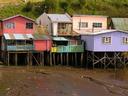
 Chiloe Island is known for its homes and buildings built on stilts. Cabanas for rent near our campground used this style known as palafito.
 -
 Another interesting local home in Nercon.
 -
 Nercon´s historic, wooden church, built in the style typical of Chiloe Island. Fifteen or more such historic churches on the Island are protected as UNESCO World Heritage Sites.
 -
 Closer to the beautiful church.
 -
 Entrance to the church.
 -
 Wooden cross.
 -
 Cemetery.
 -
 Morning rainbow over Nercon.
 -
 More palafito style cabanas.
 -
 The tiny port town of Chonchi, incredibly representative of life on Chiloe Island.
 -
 The beach at Chonchi.
 -
 Which shade of pink do you prefer?
 -
 Chonchi´s downtown buildings.
 -
 Chameleon.
 -
 Street market in Chonchi.
 -
 We went shopping too. Maciej desperately needed a new pair of pants. These ones he tried on, a little tight maybe.
 -
 These, a bit too big perhaps...
 -
 Finally, some new clothes! Maciej in his new pants (weve named them the fancy pants) and Ashe in her new sweater. Styling on Chonchi´s beach.
 -
 Looking up the hill to Chonchi´s colorful, historic church.
 -
 Chonchi´s church.
 -
 Church entrance.
 -
 Stars in the sky, inside the church.
 -
 Approaching Castro, the capital of Chiloe Island.
 -
 Castros yellow and lavender (what a combo!) cathedral.
 -
 Those famous palafitos! Love the colors.
 -
 More palafitos.
 -
 A few more.
 -
 Castro color.
 -
 Following a steep road down to another row of palafitos along the river.
 -
 More homes on stilts.
 -
 Boat as car.
 -
 How long will that hold?
 -
 Finished to match the waves.
 -
 Riverside homes.
 -
 Another palafito.
 -
 Chiloe is all water and green hills.
 -
 Boats.
 -
 Boats.
 -
 Building a boat, a skill I´d like to have.
 -
 Another row of colorful, riverside homes.
 -
 Palafitos line the river.
 -
 Another great home.
 -
 Colorful homes climbing the hill.
 -
 We´ve seen these old contraptions in farmfields throughout Chile. Any idea what they are?
 -
 Ashe riding some old farm machine.
 -
 Palafito restaurant.
 -
 Palafitos.
 -
 Local, punky dog.
 -
 More palafitos!
 -
 Take one out and they all fall down.
 -
 Ashes favorite of all the palafitos.
 -
 Taking it easy at the end of the day.
 -
 Sunset from our campsite in Cucao, the Pacific coast access village for Chiloe National Park.
 -
 Sunrise the next morning and passing the local church in Cucao as we began our long, long day hike into Chiloe National Park.
 -
 Ashe on the beach, admiring some really odd flora.
 -
 Rainbow over a local farm as we entered the Park.
 -
 Tiny, but colorful, village church in the town of Chanquin, just inside the border of Chiloe National Park.
 -
 Beginning what would be at least 15 km of walking along beautiful, deserted beaches.
 -
 A stream ending at the ocean.
 -
 Maciej with his hair all combed and looking good.
 -
 Rainbow over the beach and ocean.
 -
 We followed an incredible, wide and untouched (save for the one horse´s tracks that we followed) beach like this one for a dozen kilometers.
 -
 Ashe, taking a break on a few rocks.
 -
 Rocky cliffs in the distance.
 -
 Rustic footbridge we had to cross along the way.
 -
 River views along the trail.
 -
 Stumps.
 -
 Wild surf.
 -
 Weird plants on the beach.
 -
 Ashe, hiking through a grove of arrayanes trees.
 -
 Ashe on the beach, wearing only raingear following her fall into the frigid river.
 -
 Wet sands where river and ocean meet.
 -
 Blurry photo, very cute bird.
 -
 Coastal rocks.
 -
 More rocks.
 -
 Beautiful seas as the winds picked up.
 -
 Beautiful coastal views.
 -
 Walking along the rocky beach.
 -
 Loving the coast in Chiloe National Park.
 -
 Octopus attack!
 -
 Reindeer.
 -
 Another rustic, very remote, and apparently unused church along the trail.
 -
 Amazing coastal scenery!
 -
 Beautiful!
 -
 Views from up top on the muddy hill we had to cross before reaching secluded and remote Cole Cole cove.
 -
 Our trail and feet looked like this for about 4 hours.
 -
 Incredible Cole Cole Cove and beach.
 -
 Waves rolling in.
 -
 It´s not so easy to find beaches as deserted feeling as this one.
 -
 And there it is... a penguin! We hiked 25 km. one way to see penguins on this beach and this is what we found!
 -
 Two more penguins!
 -
 On our way back. 13 kilometers to go!
 -
 Nice footbridge.
 -
 Great river and forest views!
 -
 Amazing coast!
 -
 Rain came and went all day long. The weather is incredibly changeable in southern Chile.
 -
 Ashe at the viewpoint.
 -
 Ashe in a boat that is going nowhere.
 -
 Beach sands.
 -
 Ashe, walking the beach. 10 km. to go!
 -
 Waving to myself.
 -
 Blowing sands.
 -
 Following the river along the beach.
 -
 Us at sunset. 6 km. to go!
 -
 Beautiful sunset over beach dunes!
 -
 Sunset.
 -
 Another small shrine along the side wall of the church interior.
 -
 Small cemetery behind the church.
 -
 Achao, on Quinchao Island is home to the oldest of the Chiloe Archipelago´s historic churches. Iglesia Santa Maria de Loreto dates from 1730 and is still fully constructed in its original timber.
 -
 Plaza views in Achao.
 -
 More plaza views in Achao.
 -
 The church steeple.
 -
 Beautiful old homes along the wharf.
 -
 Working on something...
 -
 Later in the afternoon, Achao´s historic church opened its doors and we were enthralled by the incredible wood interior!
 -
 The simple altar cross.
 -
 Shrine to Mary inside the church.
 -
 The elaborately carved and colorful pulpit.
 -
 Small shrine.
 -
 Fine woodwork and color everywhere.
 -
 All original wood -- incredible!
 -
 Another elaborate shrine.
 -
 Parcel on the bus. You know you´re on an island completely dependent on fishing and the sea when you see bundles of seaweed on the bus.
 -
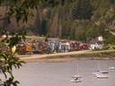
 Fishing boats in the Port of Quellon, our departure point for a ferry trip from southern Chiloe Island back to the mainland at the town of Chaiten.
 -
 More boats in along Quellon´s waterfront.
 -
 Quellon, a pretty typical southern Chilean town.
 -
 Fishing boats.
 -
 Our ferry to Chaiten began by passing a huge estuary filled with hundreds of birds.
 -
 More birds, taking flight as we passed in the ferry.
 -
 Close to sunset, view from the ferry.
 -
 Sunset over the strait from our ferry.
 -
 View of Volcan Corcovado from our parking lot campsite in Chaiten, the tiny port town and popular access point for the famous Carretera Austral, a new highway that stretches deep into the wilds of southern Chile.
 -
 Mural in Chaiten´s Plaza de Armas.
 -
 Morning mountains over Chaiten.
 -
 Chaiten´s port.
 -
 Ashe, enjoying the scenery from the back of the pick up.
 -
 Mountain.
 -
 The trail into Pumalin Park was rustic all the way.
 -
 Rainforest trail.
 -
 Ashe on one of many wooden ladders.
 -
 Staircase.
 -
 Maciej with Francois, our French friend, at one of the falls in Pumalin Park.
 -
 Bridge in Pumalin Park.
 -
 A larger waterfall in the Park.
 -
 Us at the Falls.
 -
 Out here in the land of mountains and fjords, things look like this in every direction.
 -
 These huge-leaved plants grow along the highway and into the forest, everywhere.
 -
 Mountains.
 -
 South America´s oldest, tallest trees; the alerce pine.
 -
 Those huge plants again.
 -
 Ashe by the huge plants. They are looking mighty prehistoric.
 -
 Mountains through the trees and clouds.
 -
 Views of Lago Blanco as we walked Carretera Austral back south towards Chaiten. 50 km. to go and absolutely no cars were passing us.
 -
 Along the way, La Ducha (Shower) Falls just off the road.
 -
 Waterfall rainbow.
 -
 Typical view along the Carretera Austral. Things don´t get much more wild and remote than this part of Chile.
 -
 Lago Blanco.
 -
 Great trees.
 -
 Rainforest.
 -
 Views while moving south along the Carretera Austral.
 -
 Lake views from the highway.
 -
 Driving along the highway.
 -
 Small church in the very small town of Villa Santa Lucia along the northern stretch of the Carretera Austral.
 -
 Following the unpaved highway deeper into the wilderness. We drove for 13 hours that first day.
 -
 Crossing the Golden Gate Bridge...
 -
 Horse in another village.
 -
 Mountain, almost glowing.
 -
 Lago Puyuhuapi.
 -
 Fantastic peaks.
 -
 In many stretches, the Carretera Austral cuts through deep, deep green valleys.
 -
 More great mountains.
 -
 Sunset begings, day one on the Carretera comes to an end.
 -
 Great scenery.
 -
 Great looking mountain.
 -
 Cross by the church in another tiny village along the Carretera Austral.
 -
 Town church.
 -
 Sunset peak.
 -
 Sunset over Coyhaique, the big town about halfway along the 1200 km. long Carretera Austral.
 -
 Sunrise mountains over Coyhaique.
 -
 Back on the road. On the same bus, with the same driver we continued south along the Carretera for a second straight 13-hour day. Today, we would tackle the second 400 km. stretch.
 -
 Maciej getting his mate tea fix from a giant cup at a Mate Museum along the way.
 -
 More fantastic scenery along the way on that second day down the Carretera Austral.
 -
 Passing through a multi-colored valley, entering Cerro Castillo National Park.
 -
 Mountains in the Park.
 -
 Passing through a beautiful canyon.
 -
 Craggy rocks.
 -
 Cerro Castillo, one of Patagonia´s best peaks!
 -
 Cerro Castillo looking great under a tree in blossom.
 -
 Cerro Castillo.
 -
 Fields by Villa Cerro Castillo.
 -
 Ashe under a row of blossoming trees in Villa Cerro Castillo.
 -
 Cerro Castillo.
 -
 Snowy, white Cerro Castillo.
 -
 Even fields of dandelion look great with those mountains!
 -
 A torre behind Cerro Castillo.
 -
 More mountain scenery as we continued south along the Carretera Austral.
 -
 Roadside daffodils.
 -
 Approaching Lago General Carrera, South America´s second largest lake.
 -
 Views over Lago General Carrera from the highway.
 -
 More great lake views.
 -
 As the sun came out from behind the clouds, the Lake glowed in all shades of blue and green.
 -
 Incredible!
 -
 Great colors!
 -
 Mountains along the Lake.
 -
 More lake scenery.
 -
 It´s a great looking lake!
 -
 Love those colors!
 -
 Another look out over Lago General Carrera.
 -
 Another day, another ride in the back of a pick up truck. Crossing the border from Chile to Argentina from the town of Chile Chico to Los Antiguos and onwards to Perito Moreno.
 -
 Lago General Carrera changes name to Lago Buenos Aires on the Argentinian side.
 -
 Lago Buenos Aires views.
 -
 More of Lago Buenos Aires.
 -
 Quintessential Patagonia: soft, colorful mountains rising from Argentina´s windswept plains.
 -
 Hitching our way north up the Carretera Austral highway from Chaiten, passing through Pumalin Park.
 -
 Perito Moreno Glacier, one of the most accessible and outstanding of the dozens of glaciers found in the Patagonian Ice Field shared by Argentina and Chile in southern Patagonia.
 -
 The rain and overcast skies allowed the Glacier to glow in its most outstanding blue!
 -
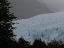 The Perito Moreno Glacier fills an entire valley. It´s 14 km. long and 4 km. wide.
 -
 Did we mention that it is almost 60 meters tall too!
 -
 The Glacier advances 2 meters daily. As it does, chunks and walls of ice crumble off of its advancing front every few minutes.
 -
 Walkways and catwalks bring visitors mighty close to the Moreno Glacier. The lowest of the platforms was closed because people kept getting killed by ice falling off of the Glacier.
 -
 Amazing blues.
 -
 Ready to fall.
 -
 It was pouring rain for our entire day at the Glacier so we had to look for cover whenever we could.
 -
 Glacier views.
 -
 The jagged river of ice fades into the distance.
 -
 Jewel-like chunk of glacial ice.
 -
 Glowing glacier.
 -
 Amazing!
 -
 A glowing block of ice floats away from the Glacier.
 -
 The Glacier loses dozens of chunks of ice daily.
 -
 Our camping spot in El Calafate, the Argentine access town for the Moreno Glacier.
 -
 On our way south from El Calafate to Puerto Natales, Chile and Torres del Paine Park. Way down here in these parts of Patagonia, there is absolutely nothing but wild plains dividing each tiny town.
 -
 First view of the range of mountains in incredible Torres del Paine National Park as we approached it by minibus. The range is all the more amazing because it rises from plains, surrounded for miles and miles by nothing more than gentle hills and grasslands.
 -
 Torres del Paines famous `towers.
 -
 Cloud cap.
 -
 The torres.
 -
 One of many, many lakes inside the Park.
 -
 Our hike along the popular W route through Torres del Paine Park began with a 6pm, 3 hour hike up into the valley with the famous Torres to Campamento Torres where we would pitch our tent for the night. As we got higher into the valley, the views behind us got better and better.
 -
 We followed this rushing river for 6 km. into the valley.
 -
 Waterfalls along the way.
 -
 Ashe passing one of the waterfalls.
 -
 Interesting flora.
 -
 Glacial ice in the mountains above our campsite.
 -
 Evening clouds moving away.
 -
 Looking up to the Torres peaks from our campsite.
 -
 The next morning, we were up at 5:15 and scrambling up boulders and slippery rocks to get to this spot: the Torres Base. Things were as cold as they were blue up this high this early in the morning.
 -
 Finally, the sunrise begins in the valley behind us.
 -
 First glimpse of the sun. 6:23 a.m.
 -
 Sunrise red on the mountains.
 -
 The sunrise light begins to crawl across to the Torres. What a sight!
 -
 Us, at sunrise and SO happy to be looking at the amazing Torres del Paine, a place weve seen pictures of for years and didnt think wed get to this soon!
 -
 Torres del Paine.
 -
 Fantastic!
 -
 More sunrise color on the mountains.
 -
 Surrounding mountains.
 -
 The lake under the Torres was perfectly still.
 -
 The bright red of the first minutes of sunrise is over and the day begins.
 -
 Wow, what a sunrise and what a place to be!
 -
 One last look at the Torres before scrambling back down the boulders to our campsite below.
 -
 Maciej, hiking back down the mountain to our campground.
 -
 Our tent in the wonderful Campamento Torres.
 -
 Mossy trees.
 -
 By sheer coincidence we ran into our Scottish friends Kat and Paul whom we met 3 weeks ago in Bariloche at our first nights campground in the Park. They had already been in the Park for a couple rainy and snowy days and were happy to begin the long day 3 hike with us in nice weather. We were happy about our timing, having missed the downpour.
 -
 Lichen?
 -
 Waterfall flowers.
 -
 Valley views as we descended back down towards the lake from the Torres valley and campground.
 -
 Great scenery and colors.
 -
 Bird.
Bird. -
 Local fowl.
 -
 Great views as we followed the northern edge of long Lago Nordenskjold towards the Valle del Frances.
 -
 More great lake views.
 -
 Ashe on the trail.
 -
 Trail flowers.
 -
 Mountain views from our lakeside trail.
 -
 When the sun did come out from behind the clouds, the lake´s waters glowed in amazing blues and greens!
 -
 Trees along the trail.
 -
 All day we looked up to views like this -- a patch of blue for a moment before more clouds rushed in from behind the mountains. The weather was incredibly changeable in the Park.
 -
 Tree.
Tree. -
 Glacial lake colors.
 -
 Along the lake.
 -
 Cloud shadows.
 -
 Lago Nordenskjold, a beautiful lake.
 -
 Part of the Cuerno range, Cuerno Principal and Cuerno Este.
 -
 A closer look at the multi-colored Cuerno peaks.
 -
 Closer still.
 -
 Trees, rocks, and snow -- that´s what this Park is all about!
 -
 Oh, it´s about glacial lakes too!
 -
 We followed the Lake for 3 hours and never got tired of the views.
 -
 Small, rock beach along the Lake.
 -
 Waterfall in the distance.
 -
 Ice in the mountains.
 -
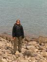 Ashe on the rock beach.
 -
 Pebble beach.
 -
 Cuernos peaks, at sunset, from our campground for the night, Campamento Italiano.
 -
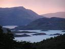 The next morning, another sunrise start, gaining altitude as we hiked into the Valled del Frances.
 -
 Sunrise over the lake, Maciej on the trail into the Valle del Frances.
 -
 Sunrise over Lago Nordenskjold and its many islets.
 -
 Fire and ice. The sunrise put a little red into the glacial ice on the Cumbre range towering over our campsite and trail.
 -
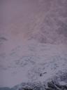 Glacier Frances in the sunrise light.
 -
 The east and west sides of the Valle del Frances couldn´t be any different. To the west, white mountains and glaciers. To the east, these craggy peaks.
 -
 We passed through thick forests on our way deeper in the Valle del Frances.
 -
 Following our trail, fresh snow along the way and more falling as we walked.
 -
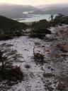 A brief ridge walk along the trail and marvelous views looking back the way we had come.
 -
 Glacier Frances and a huge pile of snow at its foot, the result of a series of thunderous avalanches we had watched with mouths wide open the evening before.
 -
 Wow!
Wow! -
 Blue sky!
 -
 More ice in the mountains.
 -
 Following our snowy trail deeper into Valle del Frances.
 -
 Mossy tree and fresh snow.
 -
 Stream with cascades.
 -
 Early morning sunlight on peaks at the end of Valle del Frances.
 -
 The winds continued to get stronger and clouds continued to roll in as we got to the end of the Valley.
 -
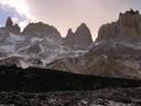 At the end of Valle del Frances and looking east towards the range of craggy peaks lining the Valley.
 -
 Looking north. Those mountains mark the end of the Valley.
 -
 This interesting tree grows everywhere in the Park. Does anyone know the name?
 -
 Following the trail back out of the Valley.
 -
 Lago Nordenskjold, looking great!
 -
 So many colors along the trail. Beautiful!
 -
 Out of the Valley and heading south to Pehoe along Lago Skottsfeld.
 -
 More peaks above us at headed south.
 -
 Looking back at imposing Cuerno Principal from our trail.
 -
 Looking up, more beautiful peaks and more glacial ice between them.
 -
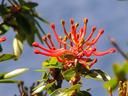 Another trailside flower.
 -
 The fabulously blue Lago Pehoe.
 -
 Grasses blowing in the strong, strong winds along the shores of Lago Pehoe.
 -
 Lago Pehoe and Cuerno Principal.
 -
 The colors of Lago Pehoe.
 -
 A tree over the lake.
 -
 Great clouds over Cuerno Principal.
 -
 Following the long, long trail through grasslands back to Park Administration where we would need to catch our bus back to Puerto Natales from. All together, we would hike 36 km. in this one day!
 -
 Views of the main range in Torres del Paine from our trail through the flatlands. We missed three days of pouring rain and it looks like more tough weather was back on its way into the Park as we got ready to leave.
 -
 Local birds (ducks?). They always travel in paris -- one white, one brown.
 -
 More ducks flying in.
 -
 At the end of our monstrous 37 km. day of hiking! We skipped the Glacier Grey leg of the hike so we didn´t end up doing the famous W route through the Park. Instead, we did the MU (as in the Greek letter)!
 -
 Why didn´t they have this at the beginning of the hike?! Checking out the great 3D topo map at Park Admin. What a Park! By the way, those lake colors are accurate -- each is a different shade.
 -
 A closer look at the map. We hiked into the first valley at the bottom, stood under those Torres (tower spires), back out, followed the lakeshore up, and into that deep valley between the yellow-ish and green peaks. To complete the famous W, hikers continue into the uppermost valley to the glacier up top.
 -
 The National Parks of Chile. We´ve been lucky enough to visit, pass through, or hike in nine of them! What an amazing natural country!
 -
 Following three days out in Torres del Paine Park, we deserved a little treat when we got back to Puerto Natales. We got our first hostel room in 6 weeks and this spread of food. Wow, what a treat!
 -
 The next morning, a quick walk through Puerto Natales.
 -
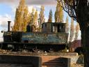 Puerto Natales main square and its grafitti-covered locomotive.
 -
 Great garbage bin.
 -
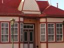 Puerto Natales may be small, far from everything, but it still has some history.
 -
 Another great historic building along Puerto Natales main plaza.
 -
 Great shingles!
 -
 Puerto Natales sits on beautiful Last Hope Sound.
 -
 Boat in the Sound.
 -
 Another boat in Last Hope Sound.
 -
 It may have delayed our full bus by 15 minutes but, finally, I got the necessary paperwork (in quadruplicate) that allowed me to bring this orange across the border from Chile to Argentina!
 -
 Beach along Golfo Nuevo in Argentinas Atlantic Coast town of Puerto Madryn, our final stop in Patagonia for some penguin, whale, and sea lion watching.
 -
 Beach succulents!
 -
 Huge whale skeleton on display near the entrance to the Peninsula Valdes Marine Reserve. We were heading out to see whales, penguins, sea lions, and more!
 -
 Ready for the whale watching boat!
 -
 OK, we have only two photos of the whales we saw out in the bay (our camera battery ran out!) and they DO NOT do justice to the experience. The whales surrounded our boat, ducked their heads in and out of the water, flipped their tails, spouted water, and passed under our boat, clearly visible in the clear waters.
 -
 Whale back.
 -
 Odd, giganto bunnies. They were huge!
 -
 Penguins! After more than a month in Patagonia and having passed several places where they could be seen at different times of the year without having seen any penguins, we finally caught up with them here!
 -
 Swimming in the waters.
 -
 Not quite the 500,000 penguins that can be seen at the colony further south at Punta Tomba (we didnt have time to go there), but still great!
 -
 Penguins arrive at this beach, climb the cliff, and make homes in tiny caves in the sand far above the surf.
 -
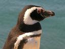 No zoom necessary! The penguins were just feet away from us! It was great!
 -
 Seeing these little guys made the entire trip out to the Peninsula Valdes Reserve well worth it!
 -
 Ashe, all smiles at the penguin beach.
 -
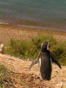 Why go back down when the sun is shining?
 -
 Resting.
 -
 Checking out the Atlantic views.
 -
 Elephant seal, relaxing on the beach.
 -
 More seals.
 -
 Nice coastline along the entire length of Peninsula Valdes and its two bays.
 -
 Us, happy as clams in this great natural reserve.
 -
 More seals on the beach.
 -
 Big, ugly guy coming in from the ocean.
 -
 He just wanted to get back together with his love.
 -
 Sunbathing.
 -
 Armadillo, making a run for it!
 -
 He came back to check us out, though.
 -
 Back in Puerto Madryn after our great day out in the Peninsula Valdes Marine Reserve.
- Spinning Out in our Fiat Hatchback
- The Mother of All Sea Lions
- Where´s the Border?
- Fly Me to the Moon
- Clueless in the Land of Volcanoes and Lakes
- Arriba! A bajo!
- Smelling Bad but Fitting Right In
- A Continent 7000 Kilometers Long, A Small Place
- Fahked by the Fahking Bus Driver
- Avalanche!
- Good Things Come
- What Time is it?
Move your mouse over a pin on the map and you will see some information here!